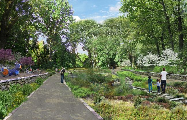
Renderings of the QueensWay, a proposed linear park in Central Queens. Source: Friends of the QueensWay)
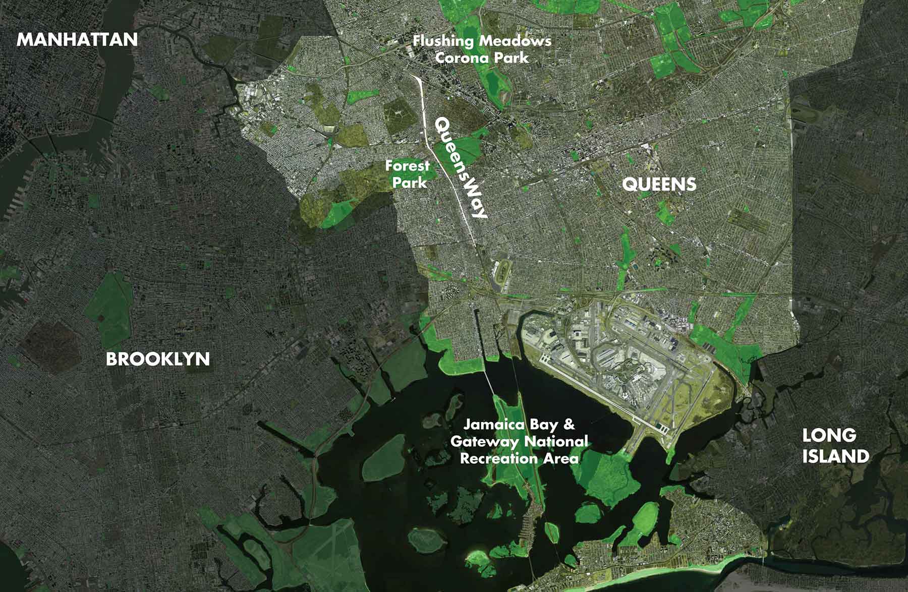
In the coming years, look for another abandoned, defunct railway in New York City to be turned a public urban park and community gateway. On the heels of the High Line’s phenomenal success come plans for the QueensWay, a 3.5-mile linear park in Queens. This time, the old railway that will be transformed is a portion of the defunct LIRR Rockaway Beach branch, which cuts across five different neighborhoods. And while the QueensWay is still very much in its early planning phase, its ambitions have the potential to change the landscape of Queens significantly.
Whereas the High Line helped resuscitate defunct businesses and helped infuse residential development into Manhattan’s west side, the QueensWay’s impact on the local community will undoubtedly be different. That’s because the QueensWay will pass through established residential and middle-class neighborhoods of Forest Hills, Glendale, Woodhaven, Rego Park and Ozone Park whereas the High Line cut mainly through a mish-mash of residential walk-ups and light industrial buildings. Additionally, the proposal for QueensWay is shaped by the needs and concerns of the local community and as such seeks to serve the existing residents, not to provide an attraction for outsiders.
History
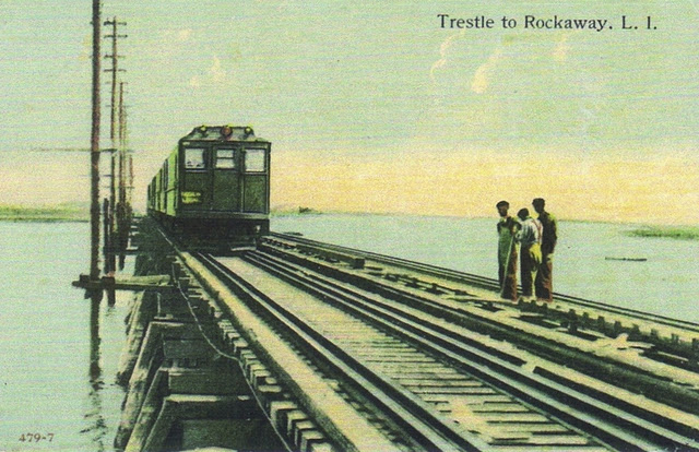
Construction of the LIRR Rockaway Beach Branch started in 1877, but the progress came in fits and starts and was not fully completed until the 1920s. The line ran from Rego Park at the northern terminus through Ozone Park out to the Rockaways cutting a corridor through the heart of Queens and then hooking west across Jamaica Bay.
(Source: Friends of the QueensWay)
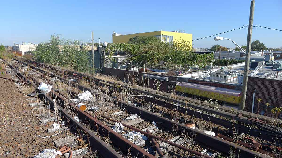
The line was marred by track fires throughout the 1940s and 50s, which leached the LIRR of funds. By the mid-1950s, it was clear that the LIRR could no longer maintain the line so a portion was sold to the city, which became the foundation of the A train in the Rockaways. During the same time, the LIRR heavily reduced service on the remaining section of Rockaway Branch Line due to decreased ridership. Service ground to a complete halt in 1962 when the operation of the line was discontinued.
(Source: Friends of the QueensWay)
Since then, the abandoned railway has become overgrown, filled with litter and serves primarily as a gathering spot for teenagers as well as illicit activity. Although there have been various attempts to reactivate the line, they’ve floundered due to high capital costs, negative environmental impacts and lack of local support.
Enter Friends of the QueensWay
In 2011, a group of Queens residents teamed up to form Friends of the Queensway, a community-based organization dedicated to converting the disused train track into a park. The group now boasts over a thousand members including neighborhood residents, local businesses, community organizations, and politicians all who are united in the common mission of enhancing access to public parks throughout Queens.
Essential to the Friends of the QueensWay’s success and viability is their partnership with the Trust for Public Land, a national not-for-profit that works to create and protect park space for public use across the country. Since combining forces, the two organizations have worked hand-in-hand to advocate for and develop a viable plan for the QueensWay. In 2012, the project received its first big infusion of funding when Gov. Cuomo gave the Trust for Public Land a $467,000 grant to study the feasibility of the project.
(Source: Friends of the QueensWay)
Then, in 2014, a state grant of nearly $444K was awarded to design the first phase of the project. Shortly after, WXY Architecture + Urban Design and DLANDstudio were hired to devise a plan based on social, economic, environmental and transportation factors that shape the area.
The current plan spec’d out begins in Central Queens and cuts through a mix of forested areas, sunken rail beds, residential neighborhoods, commercial districts, school yards, parks and ballfields before reaching its terminus just south of Ozone Park. The park will feature interweaving stretches of landscaped gardens, walking paths and bike lanes. Interspersed throughout will be space for public events, art displays and social gatherings. DLANDstudio cited the High Line as their inspiration, but not as a prototype. In contrast to the High Line, the QueensWay is designed with the local community at heart. As such it features elements and characteristics the surrounding communities currently lack.
Benefits of the QueensWay
As much as Queens is a destination for newcomers to the city and recent immigrants, it is also a place where families put down roots. It would not be uncommon to find three generations of the same family living on the same block. That is no truer than in the QueensWay neighborhoods of Forest Hills, Rego Park, Glendale, Richmond Hill and Ozone Park, where there are over 190,000 residents. Not only are these neighborhoods some of the city’s most ethnically diverse, but also diverse in terms of age.
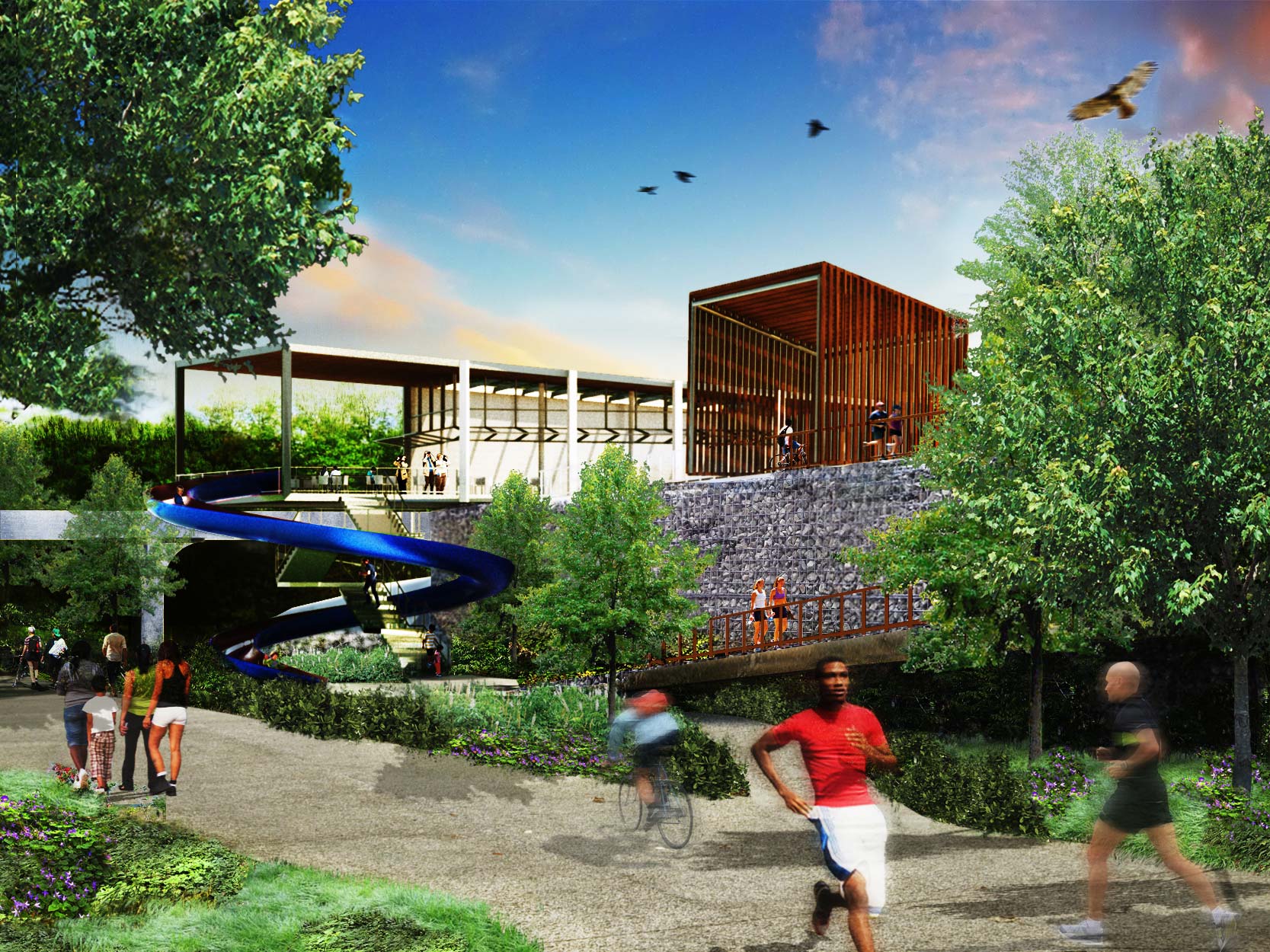
(Designs for QueensWay’s walking, biking and jogging paths. Source: Friends of the QueensWay)
Something for Everyone: The design of the QueensWay is sensitive to these divergent dynamics and seeks to offer something for everyone. It goes without saying, however, that in dense, Central Queens, everyone is in need of greater access to green space and less congested streets. Chief among the benefits of the QueensWay is that it will provide a completely protected pathway for walking, biking and running, alleviating Queens residents of the need to rely on chaotic avenues when exercising and traveling short distances.
Developed in Phases: Like the High Line, the QueensWay will be developed in phases. Phase One of the project begins at Metropolitan Avenue and extends to Union Turnpike, bisecting Forest Park. Up until this point, Forest Park has been encircled by busy commercial streets and cut off from pedestrian traffic. At the moment 70 percent of all of Forest Park visitors arrive at the neighborhood park by car. The first phase of the QueensWay would remedy that and provide direct access to Forest Park from the QueensWay pathways.
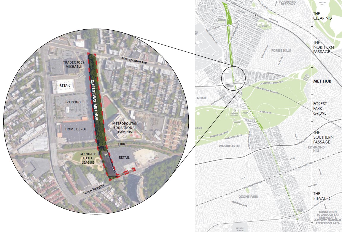
(Phase 1 of the QueensWay, referred to as the Met Hub. Source: Friends of the QueensWay)
North-South Direction: Another major benefit the QueensWay offers is its North-South orientation, which will facilitate alternative forms of transportation along the central corridor of Queens. Most major avenues and bike paths in Queens point towards Manhattan, leaving a dearth of transportation options for residents looking to travel between adjacent neighborhoods. In this regard, the QueensWay will serve as a major connector between nearby areas that have been previously isolated from one and other.
Much-Needed Green Space: Along with lacking transportation options, Central Queens also lacks green space. Sure, there is Flushing Meadow Corona Park to the north and Forest Park in the middle, but the central corridor and the associated communities and schools are cut off from nearby green space. Many public schools in the area are faced with no more than an asphalt handball court by way of outdoor facilities. Some schools fulfill their physical education mandate by having students walk around the block. In response to this lack of resources, the QueensWay proposes to incorporate outdoor classrooms and educational space into their design.
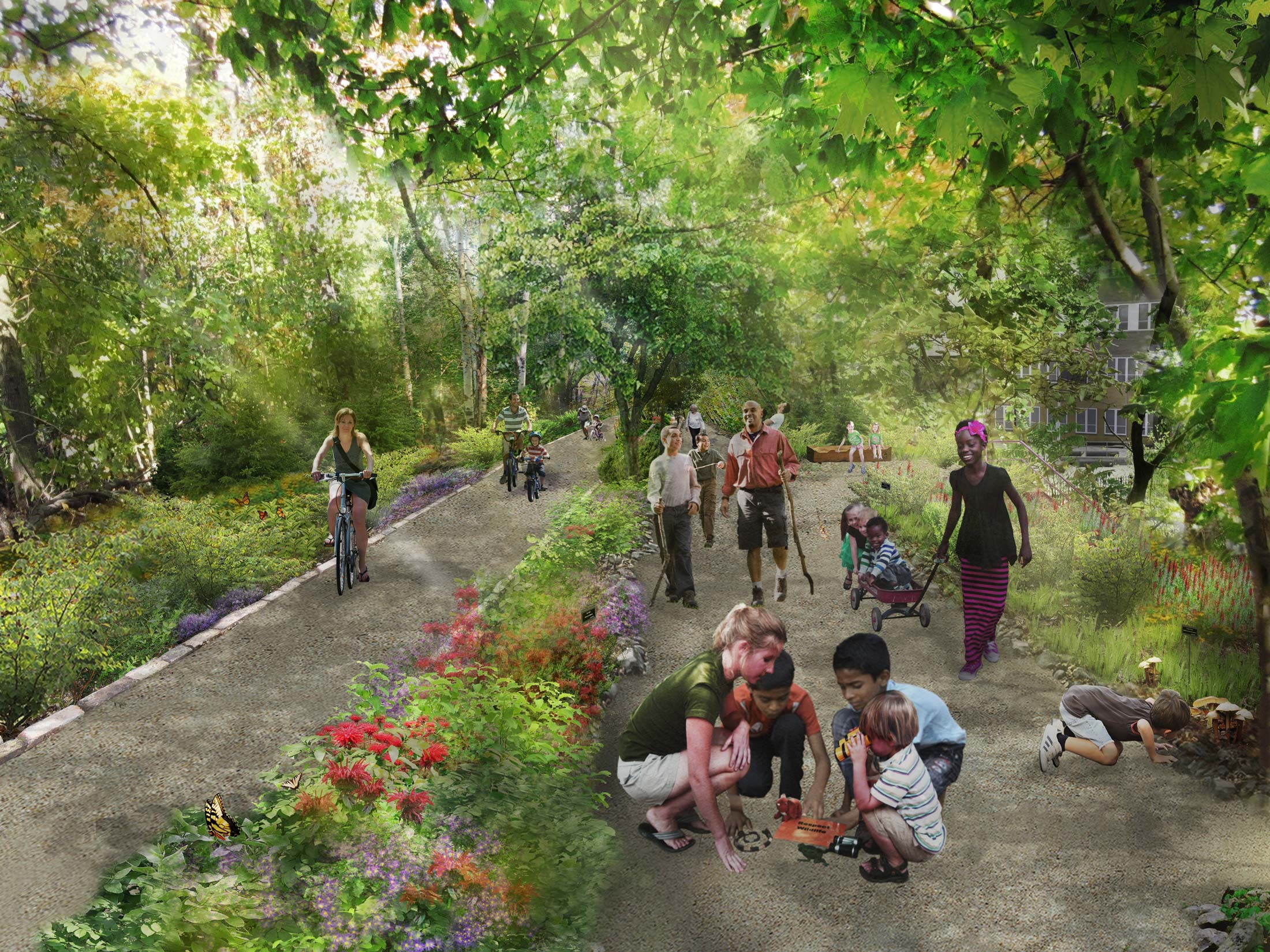
(Designs for interactive and educational environments along the QueensWay. Source: Friends of the QueensWay)
Potential Impact of the QueensWay
Last week, as part of their ongoing Projects in Planning Series, Open House New York hosted a presentation on the QueensWay at the SVA Theater in Chelsea. The audience was receptive to all the benefits during the project presentation, which was humorously accentuated by a teenager who said, “I’m 16 and I live in Forest Hills. I just wanted to say I think what you guys are doing is great. I hope the QueensWay happens.” His sentiments deftly capture the audience’s cautious, even slightly skeptical, enthusiasm.
As with any new project, however, there are “ifs,” questions and pushback. A major recurring question for the Friends of the QueensWay is how the new park will impact the surrounding areas and this is where comparisons to the High Line become less welcome.
As much as the High Line is celebrated for its innovative design, it is also known for the wave of new development and soaring real estate values it precipitated in West Chelsea. A recent StreetEasy study found that real estate in the area surrounding the High Line increased by over 50 percent in the last five years and is currently over 130 percent more expensive than properties in adjacent areas. Few would discredit the High Line for this, but the change is nothing short of jaw-dropping. To put this in context, however, it’s important to note that West Chelsea prior to the development of the High Line was not primarily a residential neighborhood where the QueensWay corridor is.
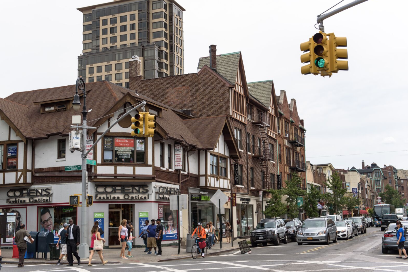
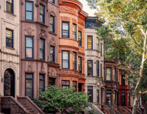
(Austin Street, the main drag in Forest Hills)
While the community views some changes as welcome and positive, there are undercurrents of apprehension about what the new park will do to the residential landscape – both in terms of density and design as well as in terms of real estate value.
A current snapshot of the real estate values in these areas reveals a true cross-section of middle-class life in New York City. In 2016, the median sales prices for these neighborhoods ranged from $290K to $650K, with Rego Park as the least expensive and Glendale as the most. Median asking rents for these areas ranged between $1,650/month and $2,100/month, with Woodhaven as the least expensive neighborhood and Forest Hill as the most expensive. The median sales price for the borough at large in 2016 was $450K.
When you compare Queens to the rest of the city, the value it offers budget-conscious families and individuals is all the more apparent. In 2016, the median sale price in Manhattan was $1.1M, almost 60 percent more than the median asking price in Queens. The comparison between Queens and Brooklyn is only slightly less dramatic, with the median sales price in Brooklyn clocking in at $825K, 25 percent more expensive than what homes in Queens commanded.
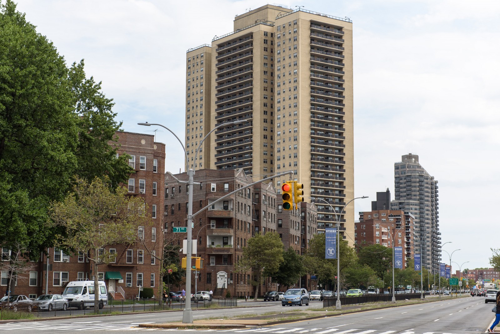
(Queens Boulevard is one of the borough’s busiest thoroughfares.)
Access to green space and bike lanes are valued amenities and there is sound reason to project that the QueensWay could catalyze real estate value in the surrounding areas. But such projections must be contextualized. While 90 percent of the High Line’s visitors are tourists, this will certainly not be the case for the QueensWay. The QueensWay Plan estimates that the majority of visitors will hail from the local neighborhood. In this way, it will not command the glitz and glamor synonymous with the High Line and perhaps the associated real estate value.
Another major distinction between the two park spaces is that the zoning within Queens is very different than the zoning in West Chelsea. West Chelsea saw a proliferation of new development following the construction of the High Line in large part because zoning ordinances changed in order to allow for greater density of residential units.
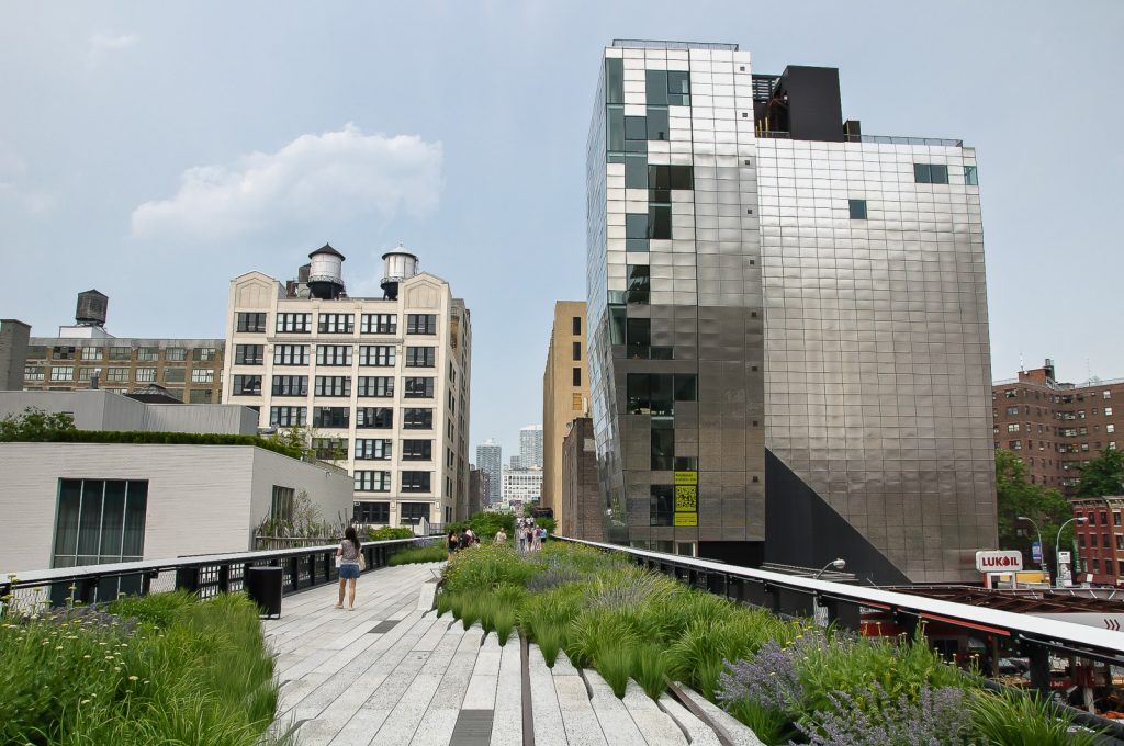
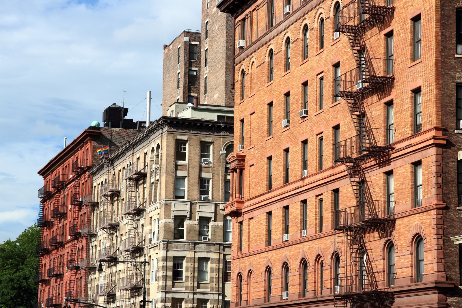
(The High Line ushered in a wave of new residential development in West Chelsea)
This does not have to be the case in Queens and given the dedication and involvement of the local community, it doesn’t seem likely that it will. The QueensWay is a grassroots project near and dear to the heart of many people who live within direct proximity to the current train tracks. It’s not a top-down infrastructure project championed by New York City business and culture elites in the way that the High Line was. In this regard, the QueensWay is positioned to be something truly different. A park for and by the people of the local community, a park that aims to serve the community’s need above all else.
Next Steps for the QueensWay
The million dollar question is when QueensWay will happen. While the benefits of the QueensWay are clear and there is a cogent plan for development, two major components are currently lacking: widespread political support and funds. Those two usually go hand-in-hand so the top priority for the Friends of the QueensWay and the Trust for Public Land is to secure endorsements from local politicians.
The construction of the park is estimated to cost $122M. By way of comparison, phase one and two of the High Line cost $152M to construct, Brooklyn Bridge Park cost $275M and Hudson River Park cost $430M. All of these parks heavily relied on city and state funding to break ground and the QueensWay anticipates doing the same.
Although Cuomo has allocated some funds to the park, the QueensWay will need far more than his original $467K grant in 2012 and a subsequent grant of $443K in 2014. To date, the QueensWay has won five endorsements from elected local officials including U.S. Congress members Joseph Crowley and Grace Meng, State Assembly Member Andrew Hevesi, State Senator Toby Ann Stavisky and City Council Member Karen Koslowitz. The Queens Chamber of Commerce has also endorsed the project, citing the park’s economic benefits to local businesses in the area. Despite the community level support, neither Mayor de Blasio nor has Melinda Katz, the current borough president of Queens, has expressed a position on the project. Although Mayor de Blasio has advocated for the rehabilitation of local parks, the QueensWay will require greater financial and policy investment from the mayor.
At the moment, the QueensWay is endeavoring to develop the park in phases with the first section serving as proof of concept. According to Andy Stone of the Trust for Public Land, if the funds and construction of the first section can mobilize, the remaining phases will fall into place. Karen Imas of Friends of QueensWay echoed Stone, “Near term game of the first section of the park seems much more plausible.” When questioned on the subsequent sections of the park, she admits “The long term game for the development of the whole park seems much more distant.”