The lights, the sounds, the density — there’s enough stimuli in NYC to make you think navigating the city is complicated. Luckily for you, streets in most of Manhattan and some other parts of NYC are laid out on a grid system that’s pretty simple to understand. Here a quick primer on how NYC streets numbers work. (Note: this guide deals mostly with Manhattan, and overlaps into the Bronx. Streets in Brooklyn, Queens, and Staten Island work differently. Read more on the tangled mess that is Queens’ street system here.)
The NYC Grid Has ‘Streets’ and ‘Avenues’ — And They’re Very Different
The first thing you need to know is that in the gridded part of Manhattan, which is most of everything above Houston Street, there are two kinds of roads: streets and avenues. They run perpendicular to each other, never parallel. Knowing where you are on this coordinate system will tell you where you are in the city.
How NYC Street Numbers Work
In Manhattan, streets run east and west, with the numbers ascending as they move north (or, as New Yorkers say, “uptown”). The southernmost street is East 1st Street in the East Village, just north of Houston Street. The northernmost is 220th Street in Manhattan’s Inwood neighborhood. Farther north, in the Bronx, the street numbers go up to 263.
Most numbered streets begin with an “East” or “West” signifier, which tells you whether you’re east or west of Fifth Avenue in Manhattan. South of 8th Street, the east/west divider is Broadway, which confuses things by snaking through Manhattan with no respect for the rules.
For navigating to a particular address, it’s helpful to remember that odd-numbered streets run west, while even-numbered streets run east. Odd-numbered buildings can be found on the north side of a street, even-numbered on the south.
How NYC Avenues Are Numbered
Avenues run north and south, their numbers ascending from east to west. In much of Manhattan, First Avenue runs along the East River, while 12th Avenue, on the other side of the island, runs along the Hudson River, and is also known as the West Side Highway.
You’ll note that this numbering system means there are some odd intersections in Manhattan. Yes, there’s a “First and First” — the corner of East First Street and First Avenue in the East Village. Maybe you’ve heard that Ramones song “53rd and 3rd”? Its title means 53rd Street and Third Avenue — and East 53rd Street, we know, because Third Avenue comes before, or east of, Fifth Avenue. The neighborhood is Midtown East.
Pop quiz: If you’re at 14th Street and 10th Avenue, where are you?
Answer: Since 10th Avenue is pretty far west, we know you’re on the West Side. And 14 is a relatively low number on the Manhattan grid, so you’re on the southwest side of the city, in Chelsea. Go get yourself a treat at Chelsea Market!
under $2,500 Article continues below
Where NYC Avenues Change From Numbers to Names
Confusingly, some NYC avenues get multiple names as they traverse the 13.4-mile length of Manhattan Island.
North of 59th Street, the avenues on the West Side change names; the avenues on the east don’t. Eighth Avenue becomes Central Park West, Ninth becomes Columbus Avenue, 10th becomes Amsterdam Avenue, and 11th becomes West End Avenue. Broadway, that old trickster, twists through all of them.
North of Central Park, at 110th Street, Central Park West becomes Frederick Douglas Boulevard; Seventh Avenue becomes Adam Clayton Powell Boulevard; and Sixth Avenue becomes Malcolm X Boulevard.
Perhaps most unhelpfully, there are actually three avenues between Third and Fifth. From east to west, they are Lexington, Park, and Madison avenues. Park Avenue runs north from where Fourth Avenue stops at 14th Street.
South of 23rd Street, there are even more avenues: A, B, C, and D, lettered from west to east, so that Avenue D is the farthest from First Avenue. Guess why this area is known as Alphabet City?
The Upper East Side has two local avenues of its own: York Avenue, which runs east of First Avenue between 59th Street and 91st Street, and East End Avenue, which runs east of York Avenue between 79th and 90th streets.
Related articles
Named Streets Are South of the Manhattan Grid
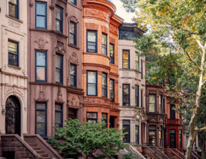
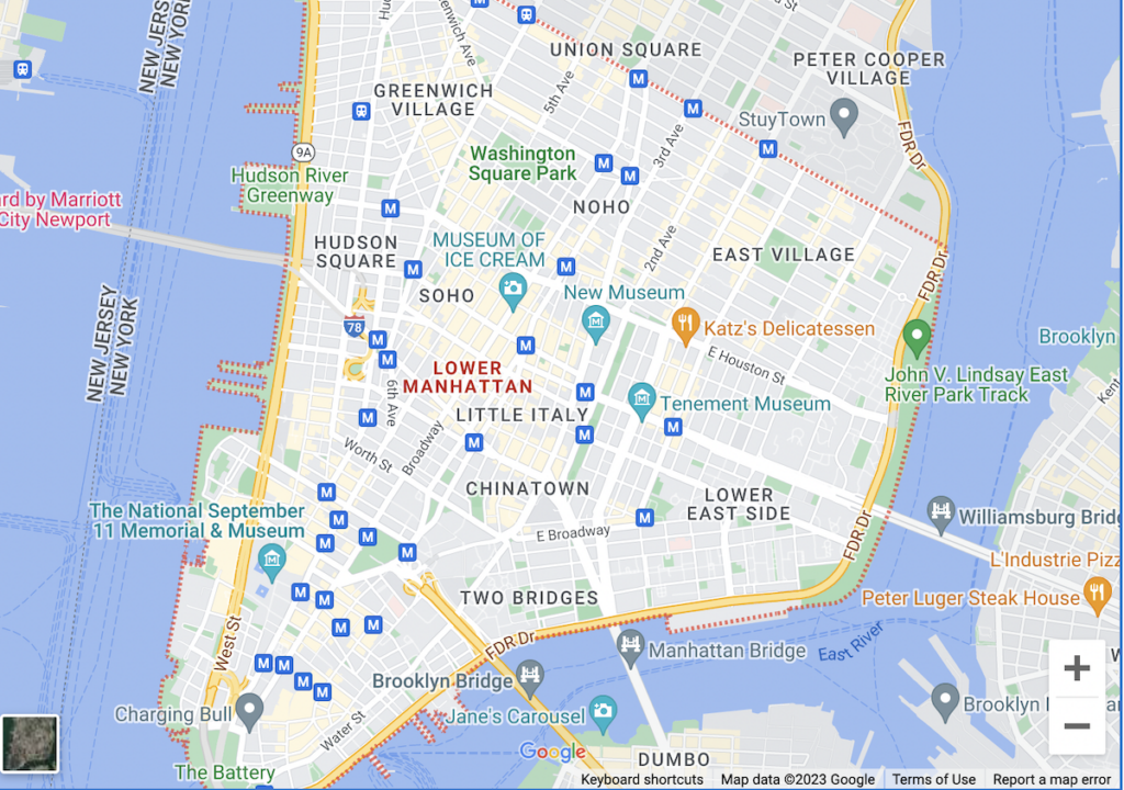
You may have noticed that we’ve only covered territory north of Lower Manhattan — 14th Street and above on the West Side, and Houston Street and north on the East Side. Below that, one look at a map shows that the streets not only get names instead of numbers, but they also get quite confusing, thanks to the meanderings of livestock way back in history and the capriciousness of early New Yorkers.
How do you navigate down here, in the oldest parts of town? It’s not so simple. Manhattan’s named streets were created before the all-important Commissioners’ Plan of 1811 introduced the famed NYC street numbers grid, giving order to the streets north of Houston Street and east of Sixth Avenue.
So unless you take to the streets like a flaneur — a modern-day Thoreau in love with the journey — we recommend Google Maps.